Video: .mp4 (1280x720, 30 fps(r)) | Audio: aac, 44100 Hz, 2ch | Size: 2.56 GB
Genre: eLearning Video | Duration: 37 lectures (3 hour, 58 mins) | Language: English
Become proficient in applied Remote Sensing (RS)/GQIS spatial analysis/ project analysis & fundamental concepts in QGIS.
What you'll learn Homepage: https://www.udemy.com/course/fundamentals-of-applied-remote-sensing-analysis-in-qgis/
Acquire a thorough understanding of satellite remote sensing principles
Learn how to apply satellite remote sensing principles in practice
Learn the most popular open-source GIS and Remote Sensing software tools (QGIS, Semi-automated classification (SCP) plugin
Create your first GIS maps for your reports/presentations
Learn how to obtain satellite data, apply image preprocessing, create training and validation data in QGIS
Learn abouit open source Remote Sensing software tools and data portals
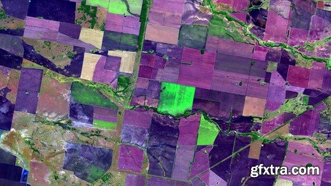
Apply Land use and Land Cover (LULC) Mapping and Change Detection in QGIS
Learn how to plan and practise to implement your first geospatial project based on Remote Sensing data
You'll have a copy of the practicals step-by-step manuals used in the course for your reference to use in for their analysis
You'll also have plenty of handy hints and tips during this course
Requirements
A working computer
The course will be demonstrated using a QGIS version of Windows PC. Mac and Linux users will have to adapt the instructions to their operating systems.
Description
Do you need to use satellite Remote Sensing in your work but don't know how to apply Remote Sensing analysis?
Do you find Remote Sensing books & manuals too not practical and looking for a course that takes you by hand, teach you all the concepts, and get you started on a real-life Remote Sensing analysis project?
I'm very excited that you have found my Fundamentals of Applied Remote Sensing Analysis in the QGIS course. My course provides you with all the necessary theoretical knowledge and practical skills to implement PRACTICAL, Remote Sensing analysis starting with the basics concepts of Remote Sensing and equipping you with all necessary knowledge and skills to implement your own independent Remote Sensing analysis Project! I will also demonstrate to you how to implement Remote Sensing analyses in the latest version of open-source software QGIS, thus that you could immediately start using satellite images for your work and projects.
This fundamental course is designed to equip you with the theoretical and practical knowledge of applied Remote Sensing analysis. By the end of the course, you will feel confident and completely understand the basics of Remote Sensing and its main components, learn how to install QGIS, and work with QGIS and Semi-Automatic Classification Plug-in, you will learn all basics of working with satellite imagery and planning your Remote Sensing project. We will learn in QGIS how to perform image preprocessing, calculate spectral indices, conduct land use and land cover classifications with Machine Learning algorithms, calculate change, and produce maps for your reports and much more. At the end of the course, you will conduct the independent project assignment that will allow you to train your newly acquired geospatial skills!
In this course, I will teach you how to work with the popular open-source QGIS software and its great tool, a Semi-Automated classification.
The course is ideal for professionals such as geographers, programmers, social scientists, geologists, and all other experts who need to use maps in their field and would like to learn more about geospatial analysis and satellite Remote Sensing.
One important part of the course is the practical exercises. You will be given some precise instructions, downloadable practical materials, scripts, and datasets to create maps and conduct geospatial analysis using the QGIS software.
Who this course is for:
Geographers, Programmers, geologists, biologists, social scientists, or every other expert who deals with GIS maps in their field

TO MAC USERS: If RAR password doesn't work, use this archive program:
RAR Expander 0.8.5 Beta 4 and extract password protected files without error.
TO WIN USERS: If RAR password doesn't work, use this archive program:
Latest Winrar and extract password protected files without error.
SermonBox - Seasonal Collection

SermonBox - The Series Pack Collection

Top Rated News


Would you like to be a Author?