3D data, city modeling, 3D analyisis and BIM GIS interaction
What you'll learn: Requirements: Description: Who this course is for:
3D Analyisis
City modeling
ArcGIS Pro and ArcGIS 10 functionalities for 3D analyisis
BIM - GIS interaction
ArcGIS pro basic
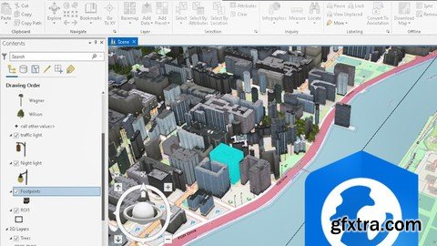
This is a course for third-dimensional geospatial analysis enthusiasts.ArcGIS is one of the most used platforms worldwide for managing GIS data. In this course, we will explore 3D functions for handling, analyzing, editing data and even interacting with BIM infrastructure modeling data. Already the maps are not only displayed in 2D, there is a need to see beyond, and even the relationship of structures or phenomena with their environment. 3D data modeling allows a better appreciation of what is happening or how to further improve the spaces, it provides a comprehensive and visually understandable analysis for everyoneIf you have knowledge in the operation and handling of 2D GIS data in ArcGIS, this course will help you delve into 3D data modeling and use the most suitable tools to build efficient projects.We must emphasize that to get the most out of this course, we recommend you check out our ArcGIS Pro Basic and Advanced #AulaGEO courses, as this one focuses on 3D content. For ease of use, some lessons show how ArcGIS 10 works since managing data is much easier than with ArcGIS Pro.Course content includes:We hope you enjoy the course.The basicsDefinition of 3d AnalystPreparing 2D data In DesktopOpening Arcgis pro/Linking folderdopening blank scene3d visualization3D visualization optionsArcGlobeArcScene3D Symbology, Editing and AnimationArcGIS Pro Demonstration3D data management3D GeoprocessingData processing/modificationAdvanced visualization and 3D data editingAdvance Visualization / ClusteringCreating/Modifying 3D buildings in 3DChanging 3D attribute for ExtrusionIdentifying Features on Base mapOther visualization choicesVisualization of new objectsViewshade on the 3D environmentBuilding information modeling for 3D GIS interoperabilityIntroduction to BIMPreparing BIM dataExploring BIM DataBIM layer controlsFinal VisualizationIn addition to the previous information, we have included at the end an introductory lesson to the BIM methodology that is important in this 4th digital age. ArcGIS as an integral platform has allowed the management of BIM data in IFC (Industry Foundation Classes) and Autodesk Revit (RVT) formats. BIM data are also GIS data sources that must be associated with a coordinate system, that is, have location specifications in order to be displayed in ArcGIS Pro, and are read as polyline, point, or multipatch features.#AulaGEO To get the most out of this course, we recommend you check out our ArcGIS Pro Basic and Advanced #AulaGEO courses, as this one focuses on 3D content. For ease of use, some lessons show how ArcGIS 10 works since managing data is much easier than with ArcGIS Pro.
GIS users
Geospatial enthusiasts
ArcGIS users
Geomatic, engineering, architecture and land management users
TO MAC USERS: If RAR password doesn't work, use this archive program:
RAR Expander 0.8.5 Beta 4 and extract password protected files without error.
TO WIN USERS: If RAR password doesn't work, use this archive program:
Latest Winrar and extract password protected files without error.
SermonBox - Seasonal Collection

SermonBox - The Series Pack Collection

Top Rated News


Would you like to be a Author?